


Greater Long Island coverage is funded in part by Toresco & Simonelli, a boutique injury and family law firm in West Islip. They fight for their clients. Click here to get in touch.
Nassau and Suffolk county executives and town leaders also declare emergencies as forecasters warn of flooding, 55 mph gusts
Long Island is under a state of emergency as a powerful nor’easter has begun to hammer the region with wind, rain and rising water.
Gov. Kathy Hochul on Friday declared a state of emergency for Nassau and Suffolk counties, along with the five boroughs of New York City and Westchester County. Forecasters warn of up to two feet of water in low-lying South Shore neighborhoods, gusts as high as 55 mph and surf topping 15 feet.
By Friday evening, ferries were tied up, weekend high school sports games were scrapped and officials were urging residents to stay home and off flooded roads.
“I’m declaring a State of Emergency for Nassau, Suffolk, New York City and Westchester as this powerful coastal storm bears down on the region,” Hochul said. “We’re expecting dangerous coastal flooding, strong winds and potential power outages through the weekend.
“Take this storm seriously,” the governor continued. “Stay alert, and avoid unnecessary travel.”
The state has activated its Emergency Operations Center. It has also pre-staged swift water rescue teams, high-axle vehicles and tree-clearing crews.
County, town leaders activate emergency operations

Suffolk County Executive Ed Romaine and Nassau County Executive Bruce Blakeman each signed executive orders declaring states of emergency Friday. They also activated emergency operations centers in both counties.
“Based on the most recent forecast, this storm is moving westward and will have a more significant impact on our region than originally anticipated,” Romaine said.
Towns across Long Island have issued their own declarations, including Brookhaven Town Supervisor Dan Panico.
What the National Weather Service is forecasting
The NWS has a coastal flood warning in effect for all of Long Island from 6 p.m. Friday until 6 p.m. Sunday.
On the South Shore of Nassau and Suffolk, water could rise one to two feet above ground in low-lying areas near the waterfront, forecasters said. The worst flooding is expected during the Saturday morning high tide.
Forecasters project major flooding at the point in Freeport and Lindenhurst.
The NWS predicts widespread flooding of roads, parking lots, lawns and basements near the water, with numerous road closures likely. Cars parked in flood-prone spots will likely take on water.
On the North Shore, water could rise one to two feet above ground, and up to 2 1/2 feet in spots. The highest water is expected about midday Saturday, with another round possible during the afternoon on Sunday.
Pounding surf is another threat. The NWS forecasts breaking waves of nine to 15 feet along Suffolk’s ocean beaches and seven to 12 feet in Nassau, with beach erosion and life-threatening rip currents.
GLI contributing meteorologist Sam Augeri the winds will continue to increase in intensity Friday night and Saturday night, with gusts topping out at 50 mph, but maybe higher on the water.
“Rain arrives later tonight with periods of rain tomorrow, but it looks like most of the heavier, steadier rain will get here on Sunday now,” Augeri said. “It will still be pretty windy Sunday with gusts 30-40 mph.”
Unsettled weather could linger into Monday, she added.
The surf was already significantly rough Friday morning in the Long Island Sound on the North Shore and along South Shore beaches.
An NWA wind advisory covers all of Long Island until 6 a.m. Sunday. Forecasters call for:
- Northeast winds of 20 to 25 mph, and 30 to 35 mph in spots
- Gusts of 40 to 50 mph, up to 55 mph
- The strongest winds happening on the East End
The NWS warned that soaked ground and trees still in full leaf are primed to cause downed limbs and potential power outages.
State officials expect possibly three to five inches on the East End.
Ferries shut down
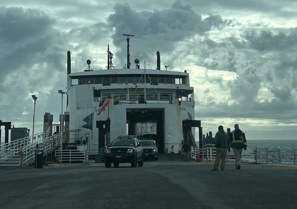
Ferry operators on both sides of the Island are pulling boats off the water.
- Bridgeport & Port Jefferson Ferry: The last boats Friday leave Port Jefferson at 6:45 p.m. and Bridgeport at 7:15 p.m. All service Saturday is suspended. The company expects to resume late Sunday morning.
- Fire Island Ferries (Bay Shore): The 8 p.m. and 10 p.m. trips Friday are canceled, and all passenger and freight service Saturday is canceled. Service to and from Atlantique is suspended through Sunday and could stay down into Monday. The company will post Sunday plans on Saturday.
- Sayville Ferry Service: All passenger service Saturday and Sunday is canceled. That covers Cherry Grove, Fire Island Pines and Sailors Haven.
- Cross Sound Ferry (Orient Point-New London): Departures are canceled through Sunday.
Long Island not ready for some football this weekend

The storm has also wiped out the weekend high school sports slate. Many Friday night games and all Saturday games across Nassau and Suffolk have been postponed, with games moved to Monday or early next week.
That includes one of the most anticipated high school sports contest of the season.
The clash-of-the-titans matchup between Massapequa and Garden City, as Greater Long Island previously reported, is now set for 5 p.m. on Monday at Hofstra’s Shuart Stadium. It had been scheduled for 5 p.m. Saturday.
Garden City brings a 68-game winning streak, the longest active run in the nation. Massapequa has won 25 in a row.
Stay safe
Officials are urging residents to:
- Stay off flooded roads
- Charge phones and keep flashlights handy
- Tie down anything outdoors that could blow away
- Residents can report power outages and downed wires to PSEG Long Island at 1.800.490.0075. Officials said to call 911 only for emergencies.
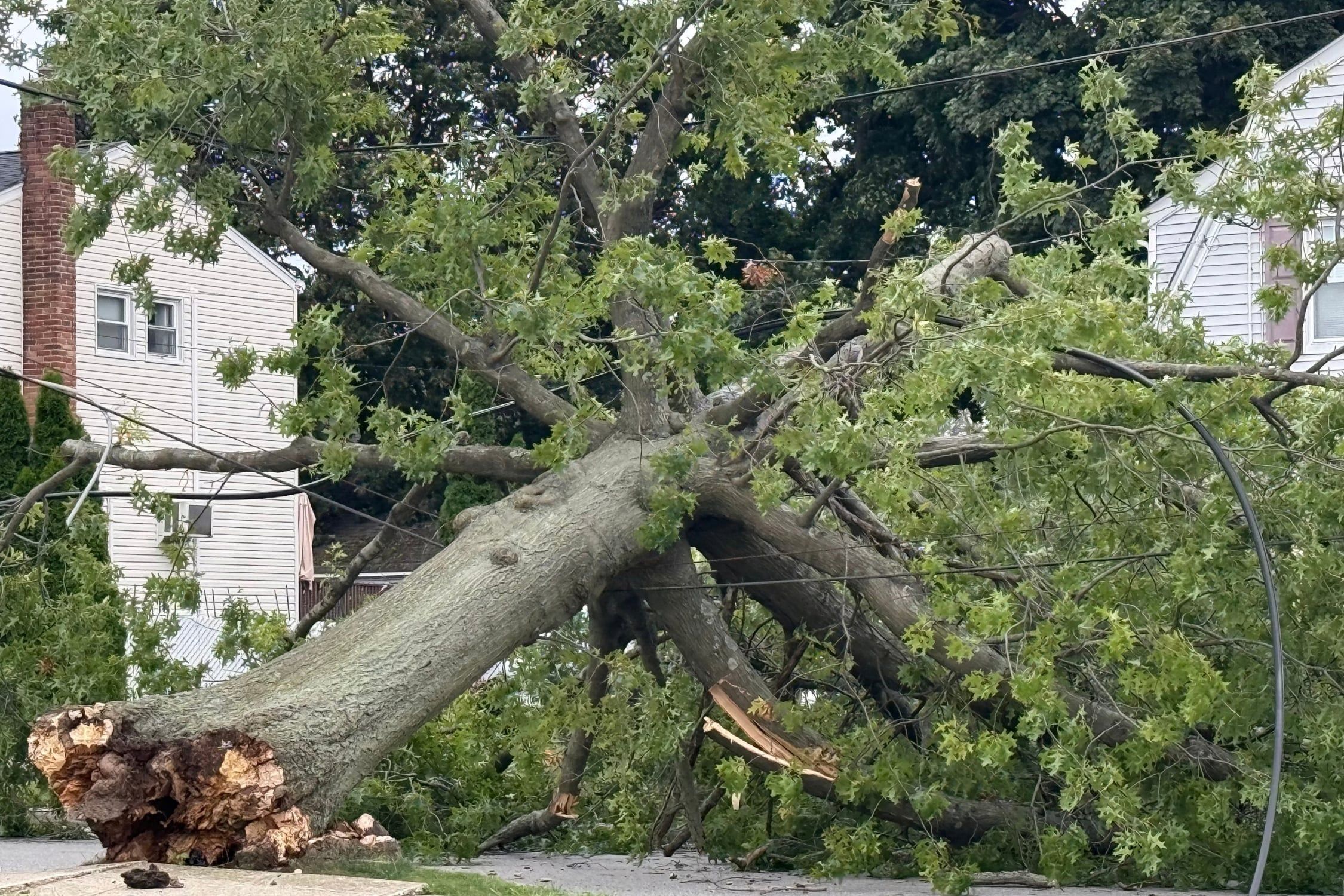
Top: Winds took down this tree Friday afternoon at the corner of Luftberry and Wantagh avenues in Wantagh (Andrew Rappaport/GLI).

Your Long Island news, delivered.
Subscribe to the GLI Newsletter — its free