OUR SPONSOR

Greater Bay Shore coverage is funded in part by Shoregate, now leasing brand-new premium apartment homes in the heart of Bay Shore. Click here to schedule a tour.
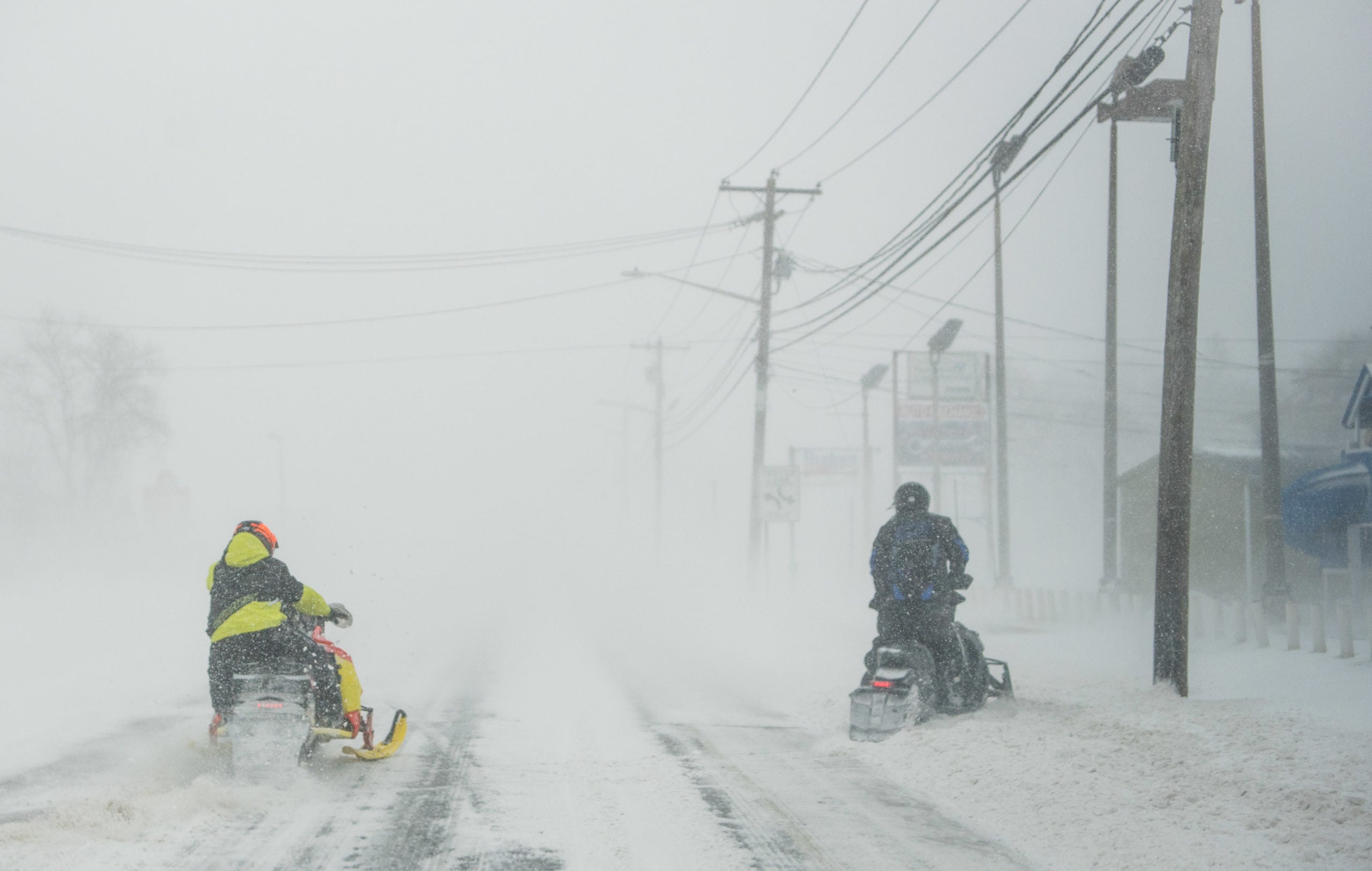
The National Weather Service has released precipitation counts from Thursday’s snow storm.
The inches vary wildly and the amount of snow exceeded expectations.
The NWS had predicted up to a foot of snow over parts of Suffolk County. But Terryville saw 16.4 inches, Medford got 16.3, and Brightwaters got 16 inches to round out the top three.
Full, updated accumulation totals for Suffolk County appear below.
Friday’s forecast is sunny and cold, with a high near 16 degrees and blowing snow. The low will be 5 degrees with wind chills between -5 and -15.
Wind gusts could reach as high as 44 mph.
Photo: St. Joseph’s R.C. Church in Babylon on Friday. (Credit: Matthew Ambrosio)
Suffolk County...
   Terryville            16.4   645 PM  1/04  Trained Spotter
   Medford               16.3   830 PM  1/04  Trained Spotter
   Brightwaters          16.0   700 AM  1/05  CoCoRaHS
   Islip Airport         15.8   700 PM  1/04  FAA Observer
   North Babylon         15.7   655 PM  1/04  Public
   Commack               15.0   950 PM  1/04  Public
   Smithtown             15.0   800 PM  1/04  Public
   Eastport              14.5   530 PM  1/04  Public
   Sayville              14.5   600 PM  1/04  NWS Employee
   Baiting Hollow        14.5   800 AM  1/05  Co-Op Observer
   Shirley               14.0   800 PM  1/04  Public
   Mattituck             13.6   700 PM  1/04  Trained Spotter
   Farmingville          13.0   530 PM  1/04  Trained Spotter
   Lake Ronkonkoma       12.8   700 AM  1/05  CoCoRaHS
   1 WSW East Hauppauge  12.6   738 PM  1/04  CoCoRaHS
   1 SSW Nesconset       12.6   800 AM  1/05  CoCoRaHS
   West Islip            12.6   800 AM  1/05  CoCoRaHS
   Shoreham              12.5   840 PM  1/04  Trained Spotter
   Bay Shore             12.4   800 PM  1/04  NWS Employee
   Bay Shore             12.4   700 AM  1/05  CoCoRaHS
   Upton                 12.3   100 AM  1/05  NWS Office
   Yaphank               12.1   630 PM  1/04  Public
   Miller Place          11.1   645 PM  1/04  Public
   Ronkonkoma            10.5   930 PM  1/04  NWS Employee
   2 SE Ridge             9.8   755 PM  1/04  CoCoRaHS
   Nesconset Highway      7.5   600 AM  1/05  CoCoRaHS
Your Long Island news, delivered.
Subscribe to the GLI Newsletter — its free