
Greater Long Island coverage is funded in part by Toresco & Simonelli, a boutique injury and family law firm in West Islip. They fight for their clients. Click here to get in touch.
With a major winter storm already locked in for Sunday, Greater Long Island Meteorologist Samantha Augeri says the bigger question now is how much snow Long Islanders will see — and where.
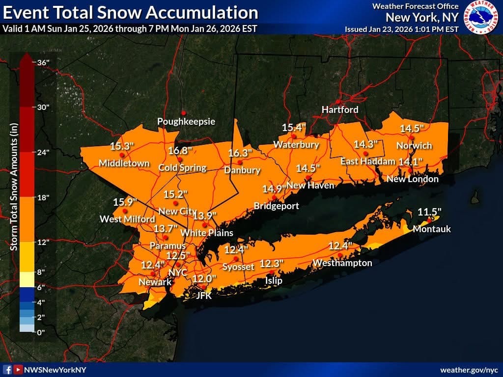
“Figure around an average of a foot across the Island, but some places will see a little bit less,” Augeri said, noting that parts of the South Shore could see lower totals if the storm briefly mixes with sleet or ice.
In her latest forecast, Augeri shows frigid air settling in Saturday, setting the stage for snow to begin early Sunday morning, sometime between 5 a.m. and 7 a.m. Conditions are expected to deteriorate quickly, with snowfall intensifying by midday and periods of moderate to heavy snow continuing through the afternoon and evening.
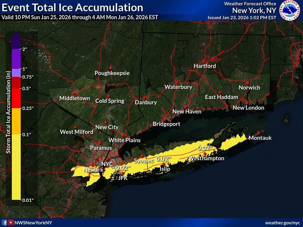
After about 7 p.m., Augeri says parts of the South Shore could see a wintry mix before the system flips back to all snow by Monday morning. Behind the storm, temperatures will remain below freezing, increasing the risk of icy roads and walkways.
Earlier Friday, Gov. Kathy Hochul declared a state of emergency ahead of the storm, allowing state agencies to coordinate with local governments and move resources such as salt and snow removal equipment where they are needed most.
The National Weather Service has issued a winter storm watch for Nassau and Suffolk counties from early Sunday through Monday afternoon, with dangerous driving conditions expected late Sunday into the evening.
Augeri says residents should plan ahead and stay weather-aware as conditions change throughout the day.
Stay with Samantha Augeri’s latest forecasts and storm updates across GLI social media platforms.
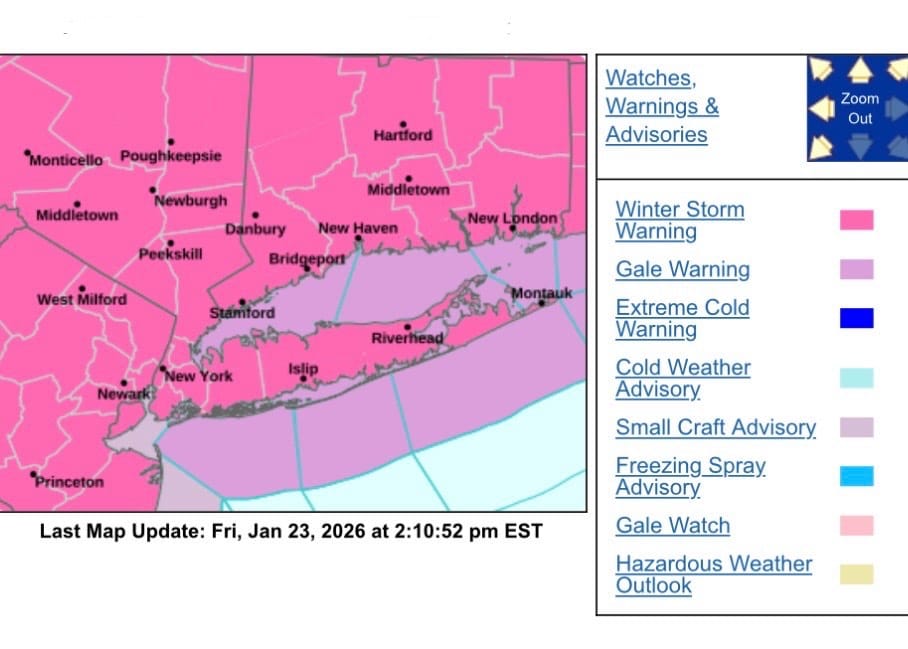
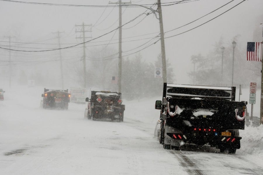
Map source: National Weather Service Photo: GLI file
Your Long Island news, delivered.
Subscribe to the GLI Newsletter — its free