
Greater Long Island coverage is funded in part by Toresco & Simonelli, a boutique injury and family law firm in West Islip. They fight for their clients. Click here to get in touch.
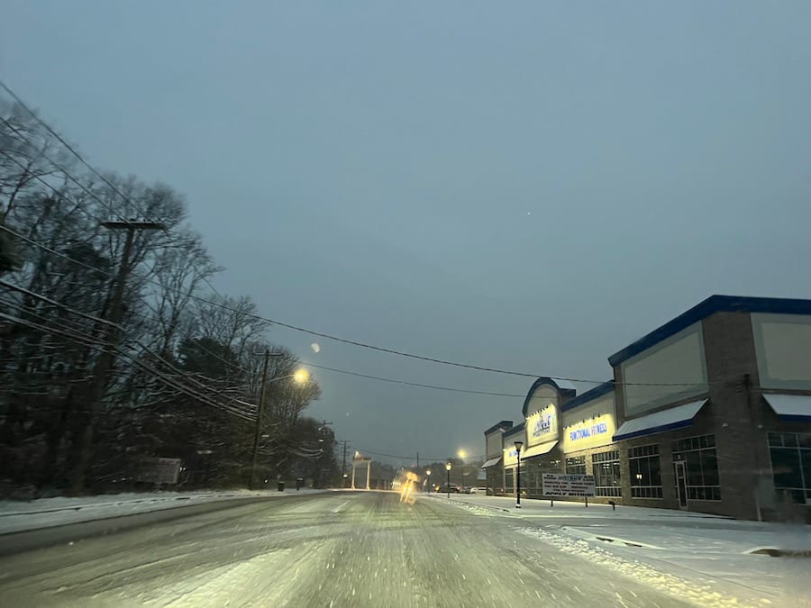
Tuesday’s morning commute was a slushy mess for many Long Islanders.
The overnight storm rolled in Monday evening, producing the island’s first snow accumulation of the winter and mucking up the roads for those heading to school and work.
The National Weather Service issued a Winter Weather Advisory until 10 a.m. on Tuesday due to the forecast of mixed precipitation.
Here’s the latest forecast (as of 9:16 a.m.) for this afternoon from the NWS: “Rain, snow, freezing rain, and sleet before 3 p.m., then a chance of rain between 3 p.m. and 4 p.m., then a chance of rain and snow after 4 p.m.”
Temperatures will dip at nighttime with a low around 19, and wind chill can drop it between 10-15 degrees, per NWS.
Be cautious while driving, as these conditions can produce slick roads, according to the NWS alert. Snow accumulations are around 2 inches across Long Island, as reported by Islandwide Weather, a service tracking the latest weather on Long Island. Some areas, such as Mount Sinai, saw a bit more, racking in about 3 inches. See the full totals below.
This storm broke a snow drought in New York City:
It’s been 701 days since Central Park last recorded an inch of snow on a calendar day.
— NWS New York NY (@NWSNewYorkNY) January 16, 2024
Latest totals as of 7 am:
❄️Since midnight — 1.0″
❄️Storm total — 1.4″
The streak has ended! #NYwx
Suffolk totals by NWS
...Suffolk County...
Mount Sinai                  3.0 in    0800 AM 01/16   COOP
Center Moriches              2.5 in    0715 AM 01/16   NWS Employee
North Babylon                2.5 in    0650 AM 01/16   Public
East Hampton                 2.3 in    0735 AM 01/16   Public
Centerport                   2.2 in    0700 AM 01/16   COOP
Islip Airport                2.1 in    0700 AM 01/16   Official NWS Obs
Sayville                     2.1 in    0700 AM 01/16   NWS Employee
Upton                        2.1 in    0700 AM 01/16   COOP
Bay Shore                    2.0 in    0630 AM 01/16   NWS Employee
Centereach                   2.0 in    0900 AM 01/16   NWS Employee
Centerport 1.1 SE            2.0 in    0700 AM 01/16   COCORAHS
Nesconset                    2.0 in    0824 AM 01/16   COCORAHS
Ridge 1.5 SE                 2.0 in    0600 AM 01/16   COCORAHS
Stony Brook                  2.0 in    0800 AM 01/16   NWS Employee
Riverhead                    1.9 in    0800 AM 01/16   Cocorahs
Centereach                   1.8 in    0600 AM 01/16   COCORAHS
Sayville                     1.7 in    0700 AM 01/16   COCORAHS
Bay Shore                    1.6 in    0700 AM 01/16   COCORAHS
Center Moriches              1.6 in    0600 AM 01/16   COCORAHS
Deer Park 1.0 NE             1.5 in    0520 AM 01/16   COCORAHS
Ridge                        0.5 in    1159 PM 01/15   COCORAHS
Nassau totals by NWS
...Nassau County...
Farmingdale                  2.0 in    0720 AM 01/16   Public
Herricks                     2.0 in    0700 AM 01/16   COCORAHS
Manhasset Hills              2.0 in    0600 AM 01/16   Cocorahs
Oyster Bay                   1.8 in    0600 AM 01/16   Law Enforcement
Albertson 0.2 SSE            1.7 in    0730 AM 01/16   COCORAHS
East Meadow                  1.7 in    0750 AM 01/16   NWS Employee
Syosset                      1.7 in    0800 AM 01/16   COOP
Bellmore                     1.3 in    0700 AM 01/16   COCORAHS
Top: Slushy road in Shirley, shot at 7:10 a.m. (Credit: Nicholas Esposito)
Your Long Island news, delivered.
Subscribe to the GLI Newsletter — its free